
To truly appreciate being a Canadian one has to, at some point in their life, visit the North where 20% of the country's land mass and water is located in the territory of Nunavut. Created in 1999, it's an area so vast and inaccessible there isn't a single road connecting any of the 25 towns and hamlets, and the only way to get there is by ship or airplane. For centuries, European explorers tried to find a way through the ice clogged waterways where the Inuit people had already been living and travelling about for thousands of years. The search for the fabled Northwest Passage was a source of frustration, failure, and ignorance until Roald Amundsen finally threaded the needle through the various islands in a multi-year voyage from 1903-1906 that followed the southern route and then by Henry Larsen, who followed both routes going west to east on the southern one and east to west on the northern one from 1940-1944.


Flying in the uniquely configured Avro RJ100 (with wings above the fuselage to allow for gravel runways) we arrived in windy Resolute (Qausuittuq - place with no dawn) and were promptly greeted by a polar bear, the standard mascot at every airport in the North. Resolute is the second most northerly town/hamlet in Canada and one of the coldest inhabited places on Earth with an average temperature of -16 C or 4 F. Located on Cornwallis Island at a latitude of 74 degrees it is nearly 1,000 km above the Arctic Circle which is at a latitude of 66 degrees. Resolute, however, comes with a troubled past as it was one of two places (the other being Grise Fiord) where the Canadian government forcibly relocated 8 Inuit families from Northern Quebec in a bid to establish its sovereignty in the North. They were left there, 2,000 km. from home without sufficient food, clothing, or shelter and had to adjust to a completely different ecosystem with 24 hour darkness in winter and 24 hour sunlight in the summer. After 50 years, various commissions, and a lawsuit, the government eventually issued an apology and paid a $10 million dollar settlement to the families for their hardship, suffering, and loss. Approximately 200 people now live in Resolute.


From the airport we were shuttled to the waiting fleet of Zodiacs that took us to our luxurious ship the Ultramarine, which was waiting patiently in the bay. After checking out our cabin and the helicopters we would be using later, we photographed our first iceberg as we left Resolute and enjoyed a spectacular sunset. By morning we were already encountering sea ice and it was only early September.


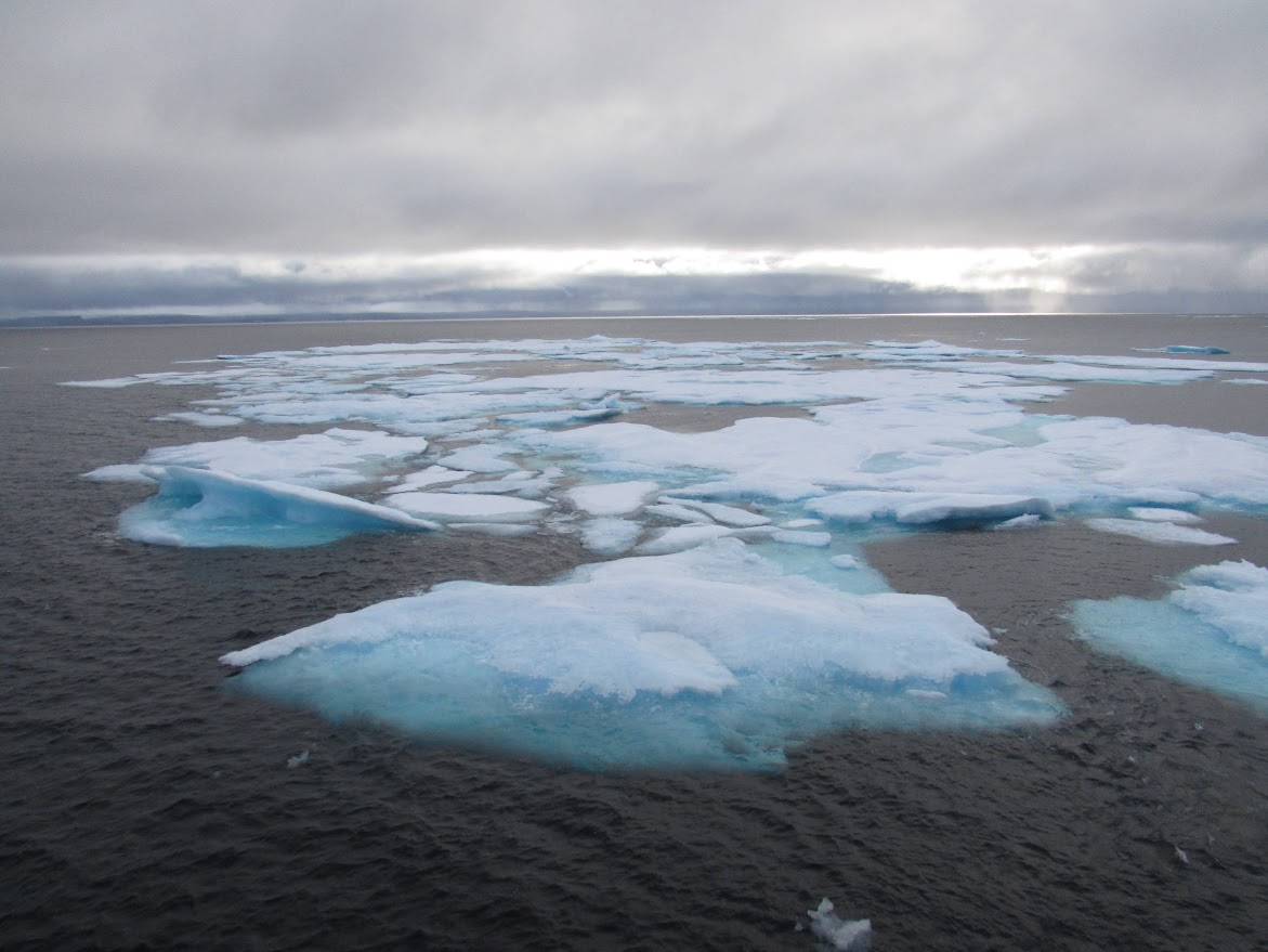
But this sea ice had some special guests who were only too pleased to pose for the excited folks on board who went into a frenzy of picture taking. It was our first polar bear sighting and we hadn't even been at sea for 24 hours. Polar bears (nanook) of course are the poster child of the north and considered by many to be the "canary in the coal mine" for global warming, as disappearing sea ice makes it more difficult for them to hunt seals and to survive.


There were more icebergs as we made our way to Caswell Tower, a rock rising 270 metres straight up from the shoreline on the edge of Radstock Bay. Between 1973-1999 a polar bear observation camp was established on the top of Caswell Tower where scientists conducted a long term study of polar bears. A magnificent view but a very lonely place to hang out for that length of time.


Caswell Tower
Here we disembarked to view a series of ancient collapsed sod-whalebone-rock houses built by Thule people hundreds of years ago. The Thule originally developed in coastal Alaska and 1000 years ago they began to expand eastward throughout the Arctic and, by the 16th century, had completely displaced the Dorset people in the process, who previously inhabited the region. The Thule were the ancestors of the present day Inuit and amongst other developments were responsible for advances in transportation and hunting techniques including the kayak, umiak, and harpoon technology, all of which enabled them to support a culture based on hunting the bowhead whale.


CASWELL TOWER
Next day the armada headed out to view the bird sanctuary at Prince Leopold Island where the cliffs rise 300 metres above sea level to form a plateau. Erosion of the sedimentary rock has formed crevices and rock ledges on the face of the cliffs providing ideal nesting spots for thousands of breeding seabirds including; thick-billed murres, northern fulmars, black-legged kittiwakes, and black guillemots.


But prowling around the base of the cliffs hoping to snack on a fallen or injured bird was another polar bear and again it was quite happy to let us take its picture as we cruised by.


Next stop was a walk/hike along the shore of Elvin Bay on rocky, windswept Somerset Island in search of muskoxen but we only found a skull to indicate they had been here previously. The forage for any animals in the North is very sparse and it's a wonder they survive at all. Navigating between these islands that have been given the ridiculous names of English lords and naval officers by so-called explorers who "discovered" them is, of course, one of the biggest colonial insults to the Inuit people who have long ago already named them. Somerset was called Kuuganajuk and Prince Leopold was called Appait.


Woke up in Arctic Bay (Ikpiarjuk - the pocket) where the annual supply sealift ship was also resting at anchor next to us. Once a year the ship sails up from Montreal with a year's supply of goods, including vehicles, building materials, fuel, and foodstuffs and it's an exciting time for the local Inuit community as everything gets unloaded. While Arctic Bay does have an airport, a sealift is of course much more economical than shipping by air and certain items can only come by ship.


Arctic Bay has a population of approximately 1,000 which is five times that of Resolute but still below the average of 1,500 for most Nunavut hamlets. Nonetheless a walk around town reveals a vibrant community with a health centre, school, hockey rink, and a community hall where we were treated to a traditional variety show that included square dancing, throat singing, story telling, drum dancing and pop singing.


Saying goodbye to friendly Arctic Bay before sunset, we worked our way back out of Admiralty Inlet with its reddish, flat topped mountains and waterfall. The geography of the North is the result of millions of years of glaciation and erosion that have successively scoured and depressed the land and then allowed it to rise once the ice melted. More than a thousand kilometres from the edge of the tree line, this part of Nunavut is even above the tundra line and mostly just a bare and rocky landscape with small patches of tundra, that support some vegetation such as moss, ground berries, and lichen.


Then, just as we were getting ready to sit down to dinner, a pod of 20+ killer whales/orcas were sighted off the starboard side and we watched in amazement as they made their leisurely way past. Looking for seals, narwhals, and beluga whales the orca have been taking advantage of melting sea-ice to expand their hunting grounds. While this may pose a problem for the resident prey it can also lead to killer whales finding themselves getting trapped in the ice, of various bays and inlets they aren't familiar with, when conditions change.


It was a tough act to follow but the next morning we awoke at the end of Croker Bay staring at the face of an active glacier. It was time to fire up the helicopters, put on our survival gear, and get into the air for a closer view. Every glacier moves at its own speed and, while they are all inexorably working their way to the ocean, this particular one is going at a rate of 10 km a year.


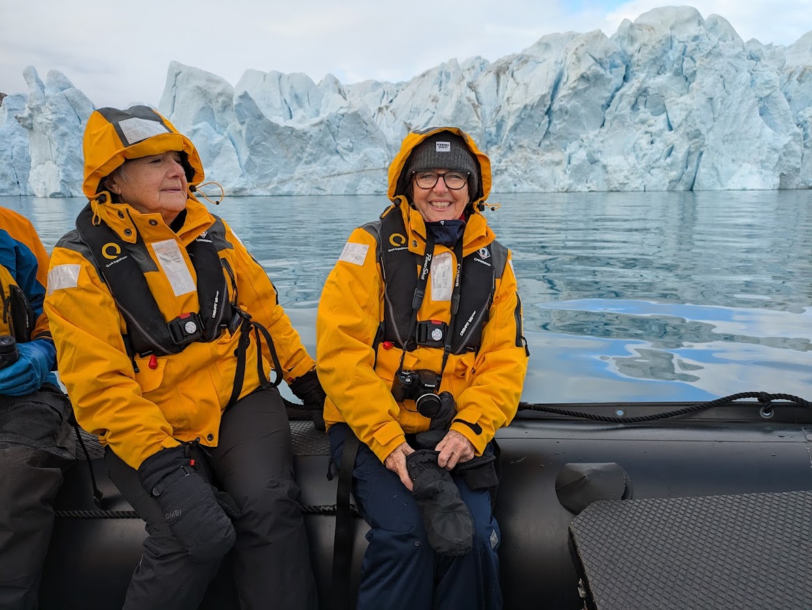
After flying over the glacier we got into the Zodiacs for something a little more up close and personal that also included checking out some of the nearby icebergs that calved off the glacier. Temperatures and weather change quickly in the North and, as the day progressed, the sea ice was starting to form an inch thick layer along the shoreline. Time to get moving says the little seabird.


But first we had to take advantage of the ice filled waters to go for a polar plunge, a highlight of the cruise that certainly warranted getting the t-shirt afterward.


Our scheduled stop the next day at historic Beechey Island (Illuvialuit) had to be abandoned thanks to 90 km/50 knot winds that had the ocean all stirred up. However, a visit with the captain at the bridge put our minds at ease as we marvelled at how well the ship handled the rough water. Beechey Island is a tiny island just off the coast of Devon Island, and is a National Historic Site. In spite of the rough weather we were able to drop anchor in Erebus & Terror Bay to view from a distance the remains of the historic monuments.


Beechey Island occupies a special place for those who transit Lancaster Sound because it contains the graves of three of John Franklin's expedition members. The graves were discovered by searchers for the lost Franklin expedition and later on another searcher who died was also buried there. Beechy Island is where Franklin's team overwintered on his search for the Northwest Passage but became icebound the following year off of King William Island and all of his crew eventually perished. Numerous searches were mounted over the years to try and find out what happened and Beechy Island was used as a base and supply depot for the various expeditions. Other significant relics include ruins of buildings, cairns, and a cenotaph in honor of all the searchers, including the French naval officer Joseph Bellot.
.webp)


Besides being an adventure cruise it was also an extremely educational one as well and everyday we were treated to an informative lecture by experts in the fields of ornithology, archaeology, geology/glaciology, history, and marine biology. It was a great way to wrap up a day's activities and get answers to questions. We all came away a little better informed about the North.

Making our way along the coastline of Devon Island, a known hangout for the elusive muskoxen (umingmak) we were once again rewarded with a wildlife sighting and everyone rushed outside to brave the cold wind and snap a few photos. Along with the bison and the pronghorn the muskox was one of a few species of megafauna to survive the Pleistocene/Holocene extinction and live to the present day.


Too soon it was time to head back to Resolute to finish up our cruise and have a final disembarkation in preparation for the return journey home. While there we took some time to explore the town and gain a little appreciation for the loneliness of life in this part of the world. The vastness of the North takes your breath away and, even with a modern ship and all the latest technology, cruising the Northwest Passage is not an easy undertaking. Our route allowed us to only explore a small yet crucial section, but it yielded awe inspiring geography, glaciers, and some of the wildlife that make this area so unique. The weather and logistics of getting up here make it difficult for tourism to really establish itself, never mind normal development, but it should be on every Canadian's bucket list to try and experience Nunuvut.


.png)
